
Call it gallivanting, but I love exploring cities alone, and flying abroad isn't an option right now. I try to drag friends along, but coordinating locations is chaotic.
Unlike cities with clear house numbers and grids, Google Maps in my region is fractured and inconsistent.
Plus Codes solve this issue, but a picture is something friends know how to send on their . It's worth a thousand words.
The realization led me to build an automation system that pulls GPS coordinates from photo memories. Here's how I now find people with turn-by-turn navigation in a few taps.
Tasker came to my rescue, once again
Who says teaching an old app new data-safe tricks is wasted?
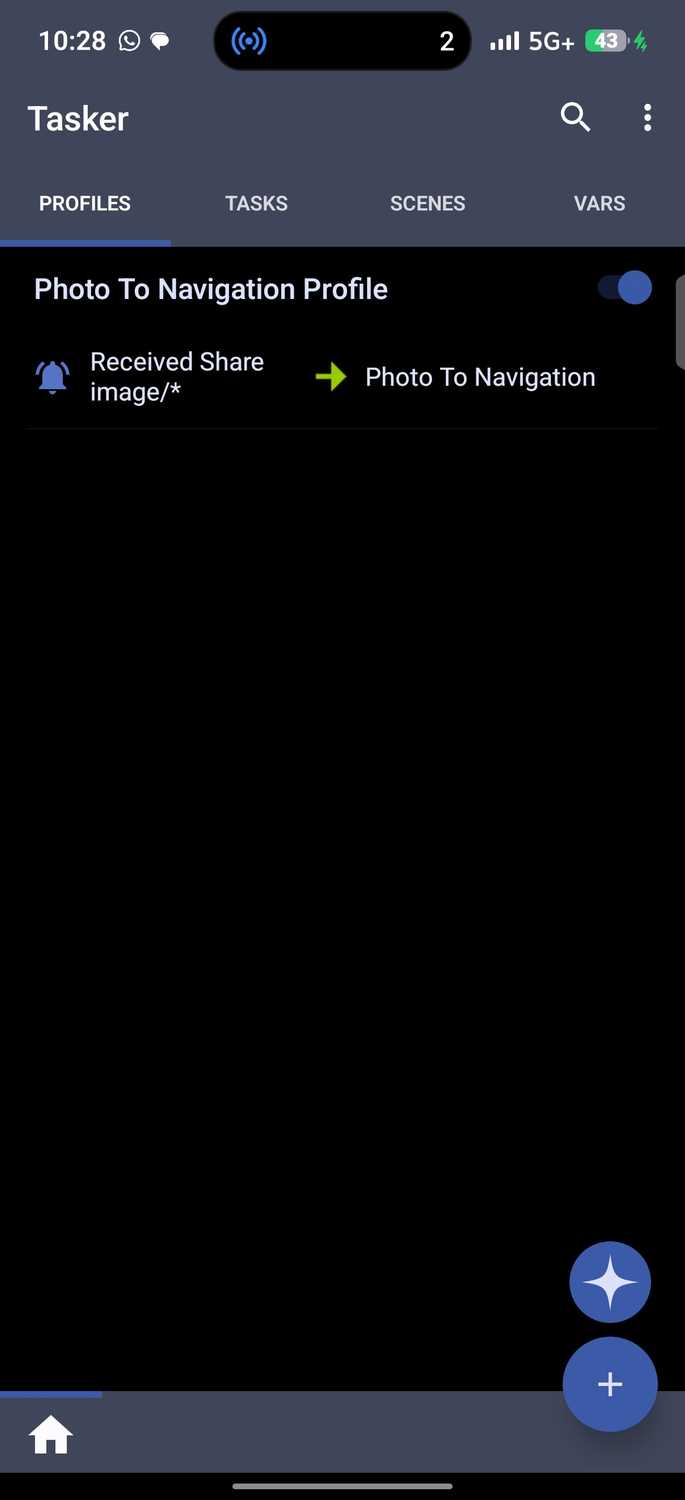
Tasker is an Android automation app that operates on rules. You'll set a trigger, and the app runs a task in response. The Play Store listing counts more than 350 actions it can perform, which is mostly why it isn't free.
It costs a one-time $4.49 fee, but there's a seven-day trial. I bought it years ago, yet I uninstalled it at some point and forgot about it.
Luckily, Google Play ties purchases to accounts, so I reinstalled it for free on my new devices. Tasker was the perfect tool for what I needed, unlike other apps like IFTTT.
In particular, IFTTT runs automations through the cloud and connects online services.
I needed a locally executed solution, especially because I was going to feed the tool people's pictures and location information. I couldn't risk compromising their data.
The idea came while I browsed TaskerNet, which is the app's public library of automations. I stumbled on a bare-bones profile called "Have GPSTag?" and a lightbulb went off.
If it could do as the description said, it could go further with a little tweaking. I didn't expect it to work, but I'm glad it did.
It's not my first rodeo with Tasker, but past attempts stalled me in its maze of menus. What changed is the time I spent learning foundational code like HTML, Python, and JavaScript with AI as my tutor.
Demystifying the basics made Tasker far less intimidating.
Ordinarily, the profile I found on TaskerNet is a diagnostic proof-of-concept. It targets a static image and queries Android's media layer to confirm GPS metadata exists. Then it prints the raw output to a variable.
It proved the phone could read the data, but it stopped there. You'd still be stuck manually copying coordinates or opening a mapping app. So I decided to build mine from scratch.
A fresh cup of Java awakens my creativity
I filtered all my ideas to perfection
You merely need to arrange them in the right order.
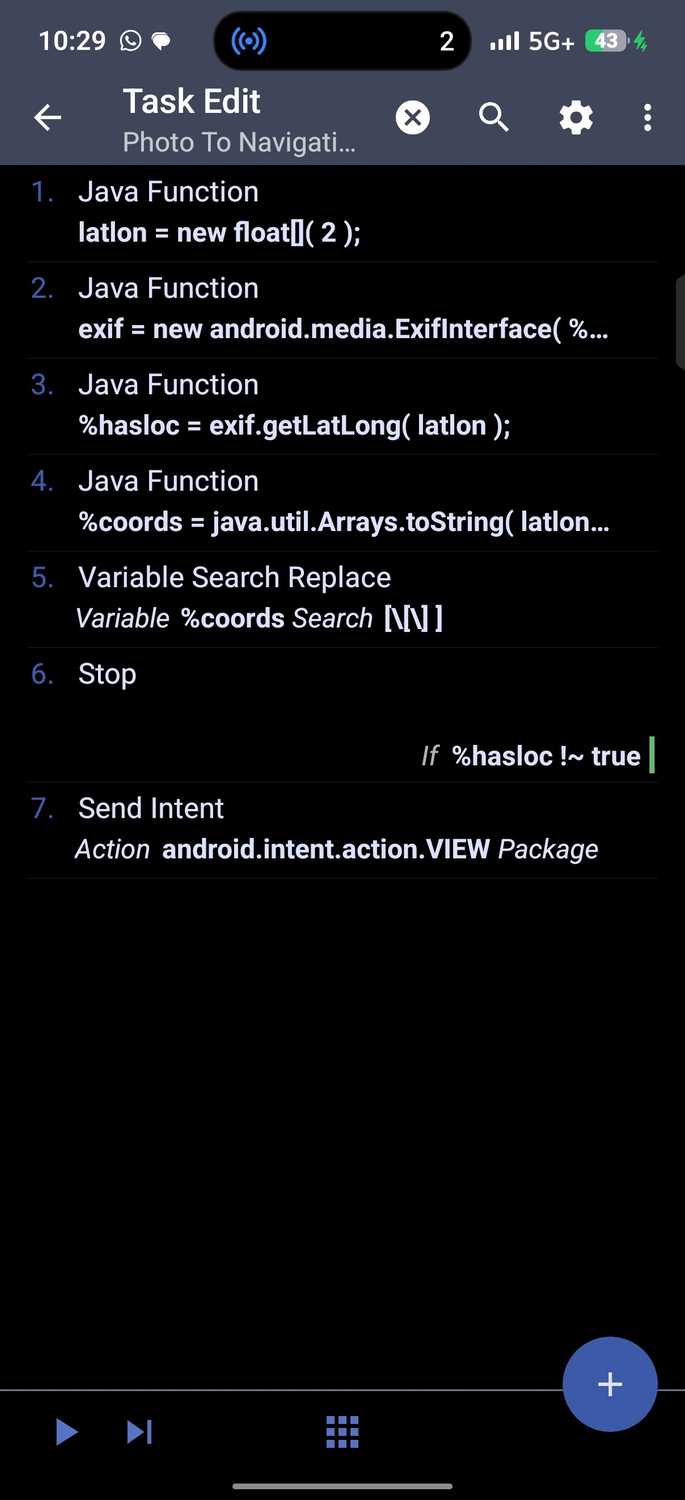
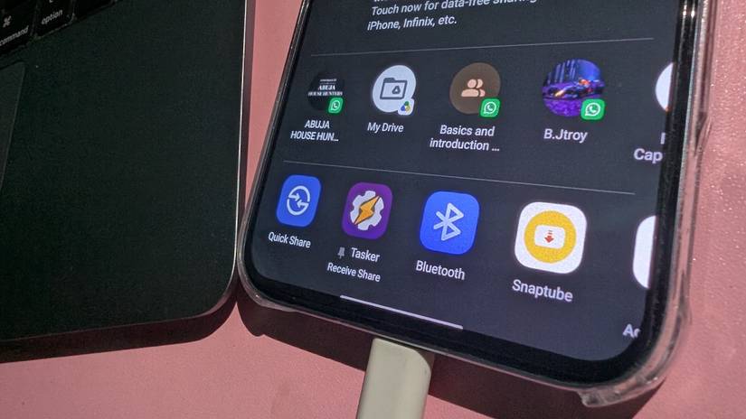
In my case, my first step was getting the automation into Android's share menu. In Tasker, I created a profile. It runs when I tap Share on a photo and send it to a Receive Share option that appears alongside supported apps.
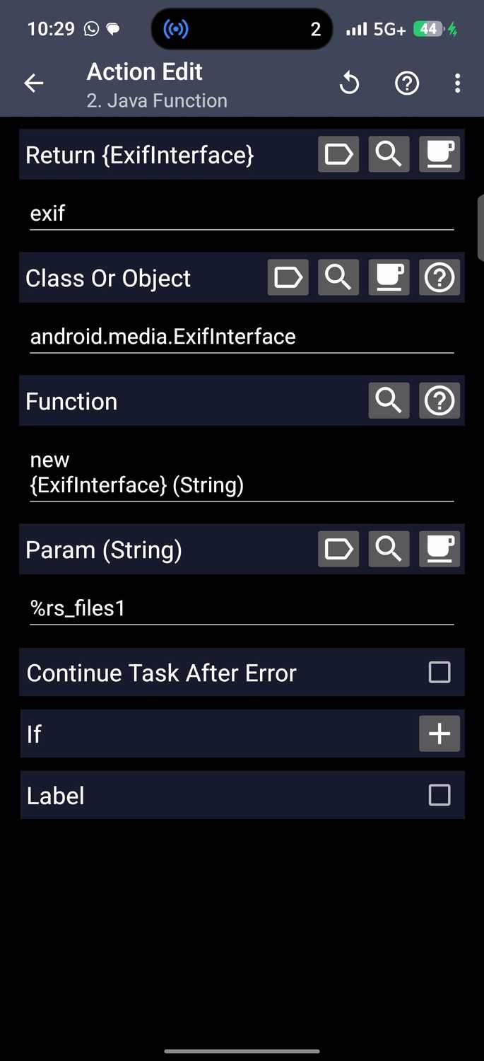
Tasker receives the photo and passes it to my action. Every image carries hidden details inside the file, like the date, the camera settings, and if location was switched on, where it was taken.
The app reads those details with Android tools, so I didn't need to install anything extra.
The tricky part is that cameras save location information in degrees, minutes, and seconds, and not the simple numbers Google Maps uses. So, instead of "6°31'27.8'' N, 3°22'45.1'' E," I got something like "6.5244, 3.3792."
Luckily, Android converted it for me. Afterward, I set a rule that if a photo has no location, the task stops there.
The last step was to send the numbers to Google Maps with instructions to start navigating. Maps skips its home screen and opens into turn-by-turn directions to where the photo was taken.
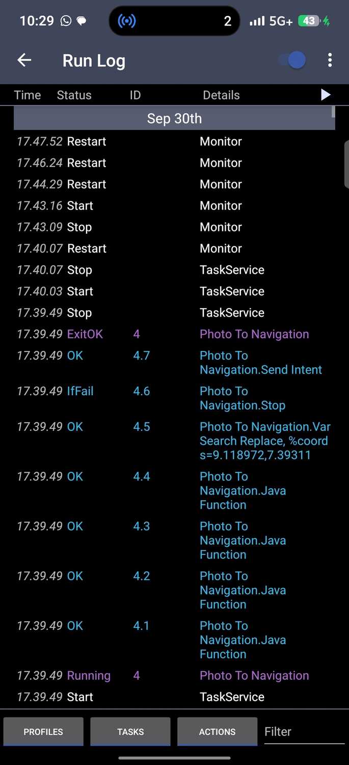
It took plenty of trial and error, but the app's Run Log menu showed me which steps failed each time. It made fixing things much faster.
I started with 12 actions in automation. It eventually dropped to 7. The extra steps were redundancy from reiterations. The process took about an hour and 10 minutes.
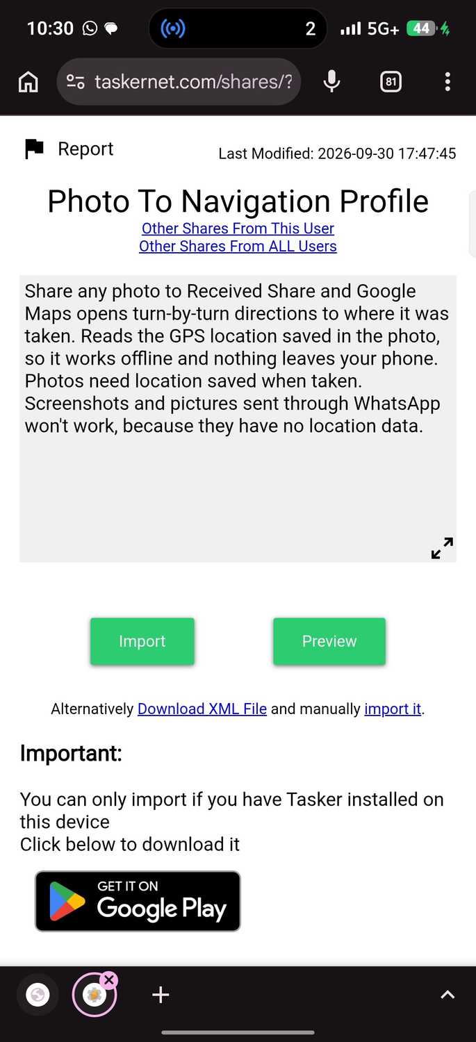
You can import my finished Photo To Navigation tool from TaskerNet.
Ensure location tagging is turned on in your camera app. Photos taken without it have no coordinates for Tasker to read. Go to > Save location or .
Some gallery apps let you strip location data when sharing a photo. Make sure this option is off if you want the coordinates to stay intact.
All the memories bring you back to a location
Cheers to revisiting that one spot we all love
For now, it can't work with most social media apps unless you decide to send them via email or cloud storage.
You don't want someone tracking you to your home from that one picture you posted weeks ago, especially when anyone can find you if you don't actively strip metadata.
For now, the best use case might be for memorable moments. You probably went to a nice eat-out or café spot and forgot the location in a new city. Your photos could be the key to finding it again.
Build your dream tasks
You don't need to be a programmer to . If you're having trouble, opening Gemini beside you and asking it any question you have can help.
It's a great tool for spotting mistakes, and it gives you a third eye on details you might overlook. Still, remember that AI tutors might be confidently wrong sometimes.