My recent discovery of a Roman fort and its extraordinary connection with medieval folklore was the fruition of many hours of painstaking research.
This all began in 2002 when I discovered or, more accurately, rediscovered a Roman villa some 30 kilometres to the southwest of Wales. The site was first identified in the early 19th century by Richard Fenton, a local antiquarian. For several reasons, his reliability has been questioned, but mostly because of the perception that the Romans did not reach west Wales was rife in the Regency period and persists to this day.
When my team and I were digging the villa, a local volunteer asked what a Roman site of this status was doing in the middle of nowhere. This was a good question, and I did not know the answer. However, the archaeologist Sir Mortimer Wheeler dug a similar site on the same latitude in 1922, and I reasoned that both sites could lay close to a Roman road. This began a quest to trace a network of routes through west Wales.
A stretch of Roman road was in fact identified by Fenton in the vale of Whitland. This was excavated in 1995, in advance of the construction of a bypass, but I felt that there was more of a network to be discovered. I made breakthrough in 2022. Several other Romano-British sites have been discovered since Wheeler’s day, including a fort at Wiston near Haverfordwest in 2012–2013, and several villas.
Like Fenton, my observations have attracted a good deal of scepticism, but my heart and mind felt that I was making considerable progress tracing the Roman road network from Pembrokeshire east into Carmarthenshire.
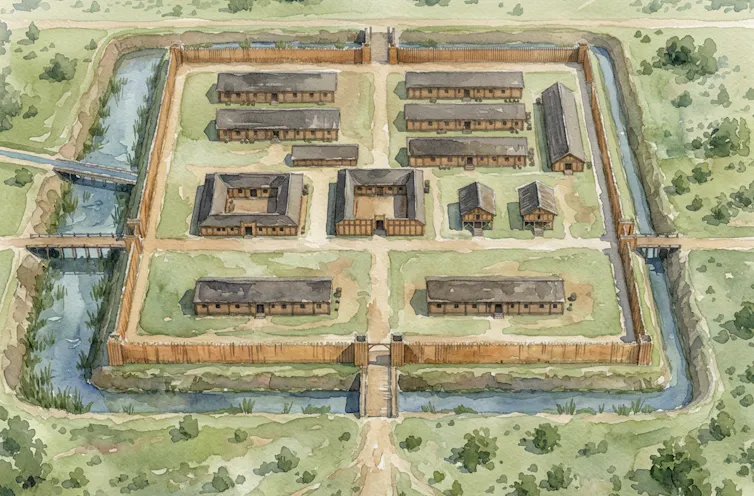
My theory received a boost in 2024 with the observation of earthworks suggestive of a Roman auxiliary fort adjacent to an almost certain Roman road near Crymych in north Pembrokeshire. The earthworks had a characteristic playing-card shape like auxiliary forts and was about three hectares in area, which is typical for this type of military installation.
One corner has been destroyed by the construction of a post-medieval settlement (the village of Crymych), which is still inhabited today. The south of the enclosure is intersected by a leat (aqueduct) which enters the site through a masonry channel. Every Roman fort of course needed a water supply. The site lies adjacent to the A478, which runs straight in that area, and many sections further south are similar, but the line is lost in places which is often the case with Roman roads.
It is my belief that it is part of a previously unidentified major arterial Roman road connecting modern Pembrokeshire with Ceredigion to the north.
My hypothesis gained traction with the results of a limited geophysical survey in October 2025, which placed two rectilinear (straight-lined and right-angled) buildings in the right place. Trial excavations followed in March and July 2025 and a steady trickle of finds followed, including coins, a gaming counter, some Roman pottery and a spindle whorl for spinning wool. A more comprehensive evaluation excavation was needed, however, to establish for certain whether the site was a Roman auxiliary fort.
Connections to Welsh mythology
When I discovered the site in 2024, I began to think that it may relate to Cadair Maxen, the camp of the Roman emperor Magnus Maximus (Macsen Wledig in Welsh). He’s mentioned in the Mabinogion (a collection of medieval Welsh stories) in The Tale of Emperor Maxen, also known as The Dream of Macsen Wledig.
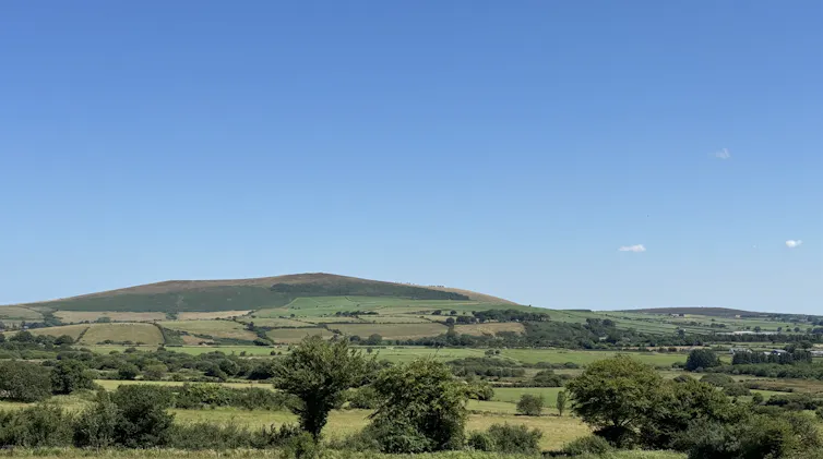
This places the late 4th century usurping emperor on the Frenni Fawr, the easternmost peak of the Preseli Hills, which dominates the site a little over three kilometres to the north-east. However, there are no visible remains of a Roman marching camp on the Frenni Fawr where the emperor is said to have visited.
Our breakthrough came in early September with the excavation of five trenches. Three across the suspected principal buildings (the commander’s house headquarters building and granaries); one in the area to the north where a perimeter road would be expected; and another up-slope where the geophysical survey (non-invasive ground scans detecting buried stone structures and drainage ditches beneath the soil) indicated a track.
In the first and second trenches, we identified the bases of floor structures built of clay and packed with the remnants of thin stone blocks. Many of the latter had been disturbed by intermittent ploughing over many decades.
In the second trench there was a diagonal alignment of stones, which indicated a later phase of civilian occupation. We recovered many pottery sherds, particularly in the second trench and found a kiln which yielded many fragments of Roman ceramic tile.

The third trench had a clay floor consistent with Roman granaries. In the fourth trench we unearthed the remnants of the rampart base and a road surface below plough level with rut marks on their expected orientation. The fifth trench did indeed reveal a track. Its date has yet to be established, but we did recover a small number of pottery sherds which are seemingly Roman.
Other new finds from the site include a lead spindle-whorl, an iron stylus for writing documents and letters on wax tablets, a woodworking axe, a gaming counter, a third-century coin and two later fourth century coins.
The collective findings indicate that the site was once a typical timber fort, probably established during the campaign of the governor Sextus Julius Frontinus between AD74 and 78. It does indeed suggest a connection between the camp of Magnus Maximus mentioned in the Mabinogion and the site I first identified in 2024. Magnus Maximus will feature in my forthcoming book, Lives of the Roman Emperors: From Augustus to Romulus Augustulus.
The earthworks are still visible today, almost certainly adjacent to a major Roman road, and would have been more conspicuous in the 4th century and listed on official itineraries. The discovery represents an extraordinary fusion between myth and reality and demonstrates that folklore is often underpinned by fact.