I used to open Google Maps only when I was ready to leave, check the traffic, pick the fastest route, and head out.
It seemed like the obvious way to use a navigation app. That routine worked, but it also meant I was reacting to congestion instead of planning around it.
The route was rarely the real problem. My timing was. After I started using a feature that lets me check travel conditions for a specific departure time, Maps became far more useful.
I was checking the traffic too late
Last-minute planning can be a disaster
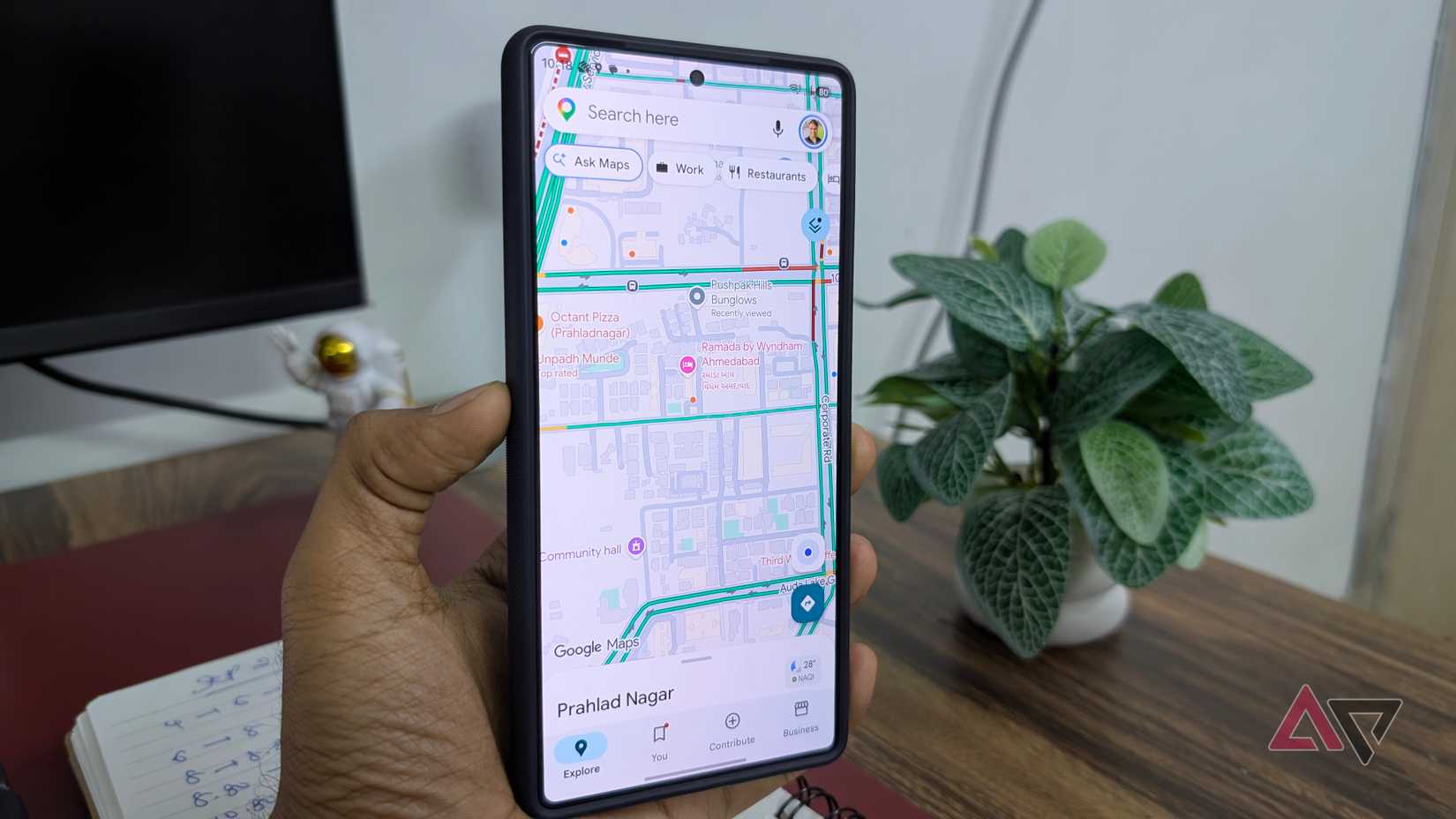
My biggest mistake with Google Maps was not the route I picked. It was when I opened the app.
I usually checked Maps only after I was completely ready to leave.
By then, I had grabbed my keys, walked to my car, and mentally prepared to get on the road.
If Maps showed heavy traffic, I could switch to an alternative route, but that only helped so much. I was still leaving during the same congested window.
That meant I was using Google Maps reactively. I was asking it to rescue my commute after traffic had built up, instead of using it to plan around congestion.
I started comparing different departure windows
Different departure times changed everything
After I found the departure-time option, I started doing something I had never bothered with before: checking the same route multiple times.
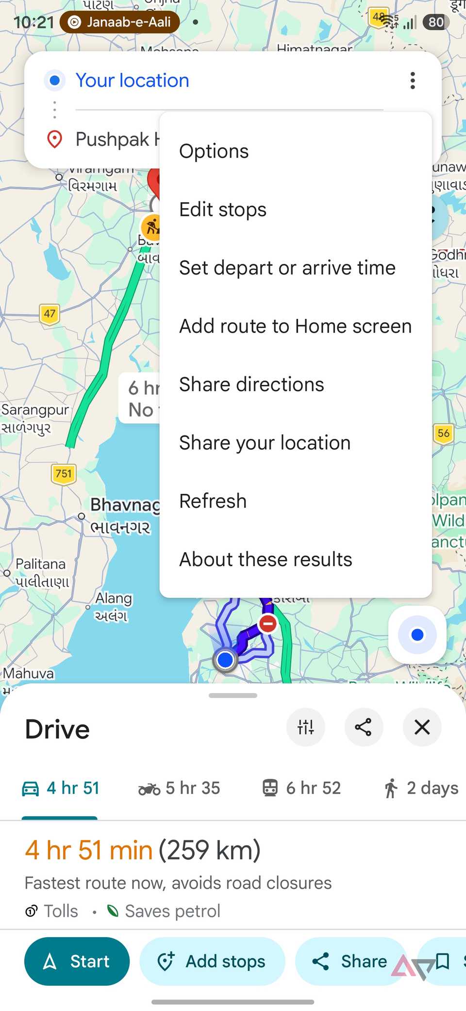
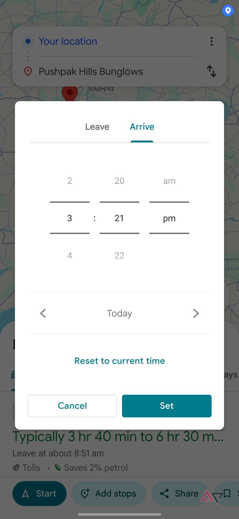
Instead of opening Google Maps only when I was ready to leave, I now search for my destination, open the route options, tap the three-dot menu, and choose Set depart or arrive time.
From there, I can move the departure time forward or backward and see how the estimated journey changes.
I usually compare a few realistic windows rather than obsessing over every five-minute difference.
For example, if I am heading somewhere in the morning, I might check 8:30 AM, 9:00 AM, and 9:30 AM.
Sometimes the difference is minor. Other times, shifting my departure by 20 or 30 minutes can make the drive easier.
This is useful when my schedule is flexible. If I am heading to a coworking space, a shopping mall, a family event, or a meeting where I don't need to arrive at an exact minute, I can choose the window that looks less congested.
I also find it handy before airport runs or longer drives, where getting stuck in peak traffic can throw off the entire plan.
It made planning my mornings easier
Use the Arrive by time option
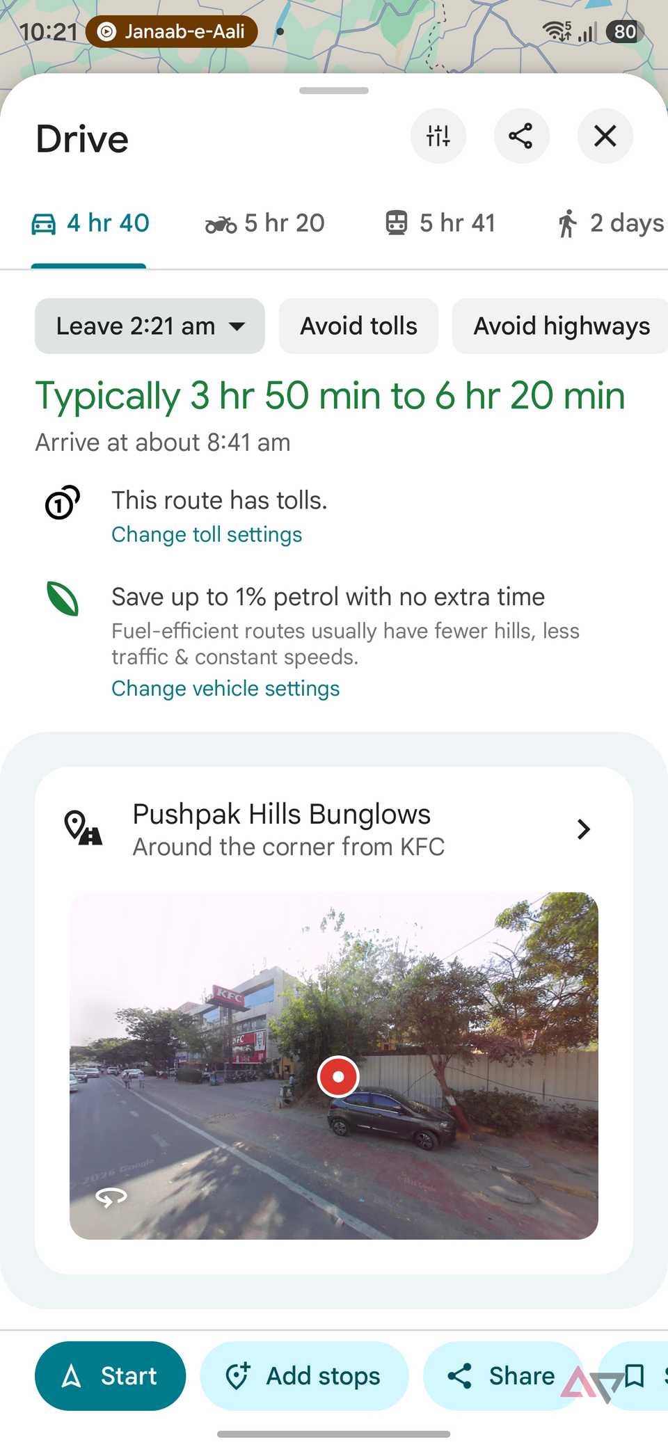
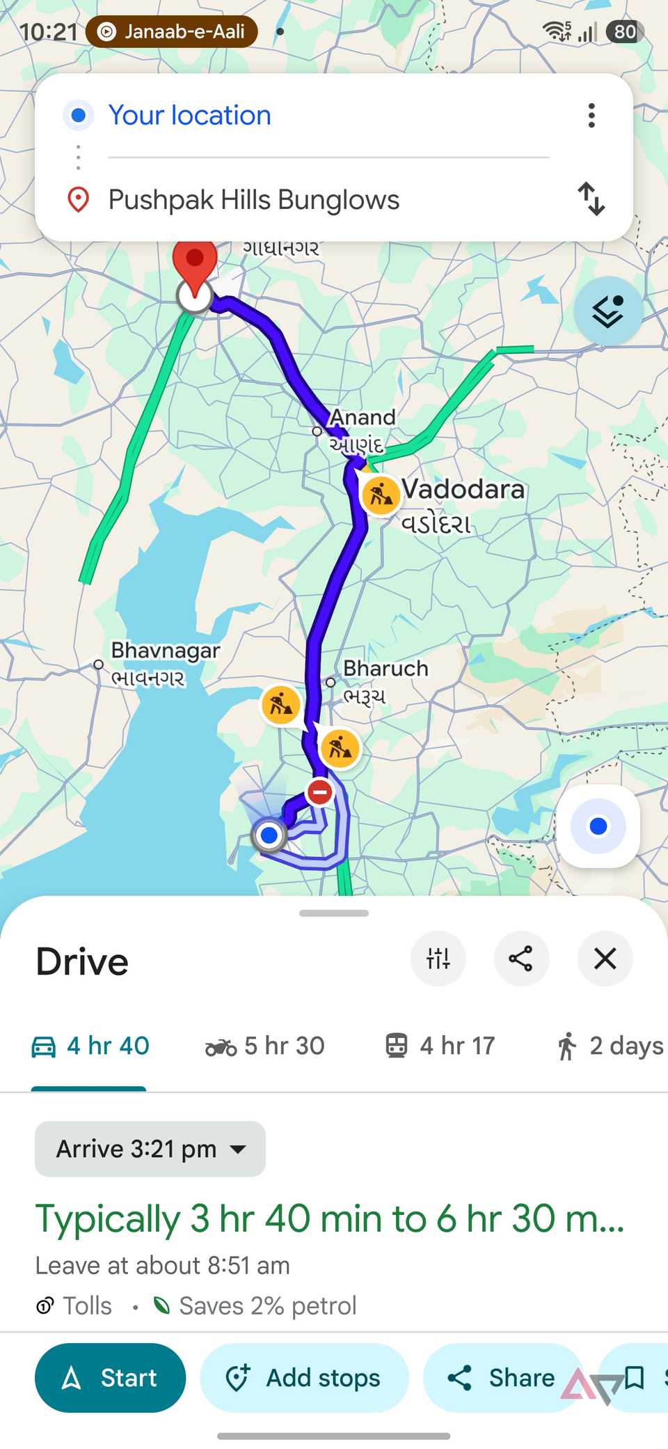
I also use the Arrive by option quite a bit, especially when I know exactly when I need to be somewhere.
A good example is a hotel stay. If check-in starts at 2 PM, I can set 2 PM as my arrival time in Google Maps and get a better idea of when I should leave home.
That saves me from doing the mental math or checking the route repeatedly as the day gets closer.
I use the same trick for appointments and meetings. If I have a meeting at 11 AM across town, I set 11 AM as the arrival time and see what Maps recommends based on expected traffic.
This has made my mornings easier instead of constantly checking the clock and wondering whether I still have time for breakfast, coffee, or a few small tasks. I already have a realistic departure target in mind.
It removes a surprising amount of guesswork from my routine.
For me, Arrive by is less about navigation and more about planning the entire morning around one fixed deadline.
I still check live traffic before leaving
I still trust live traffic
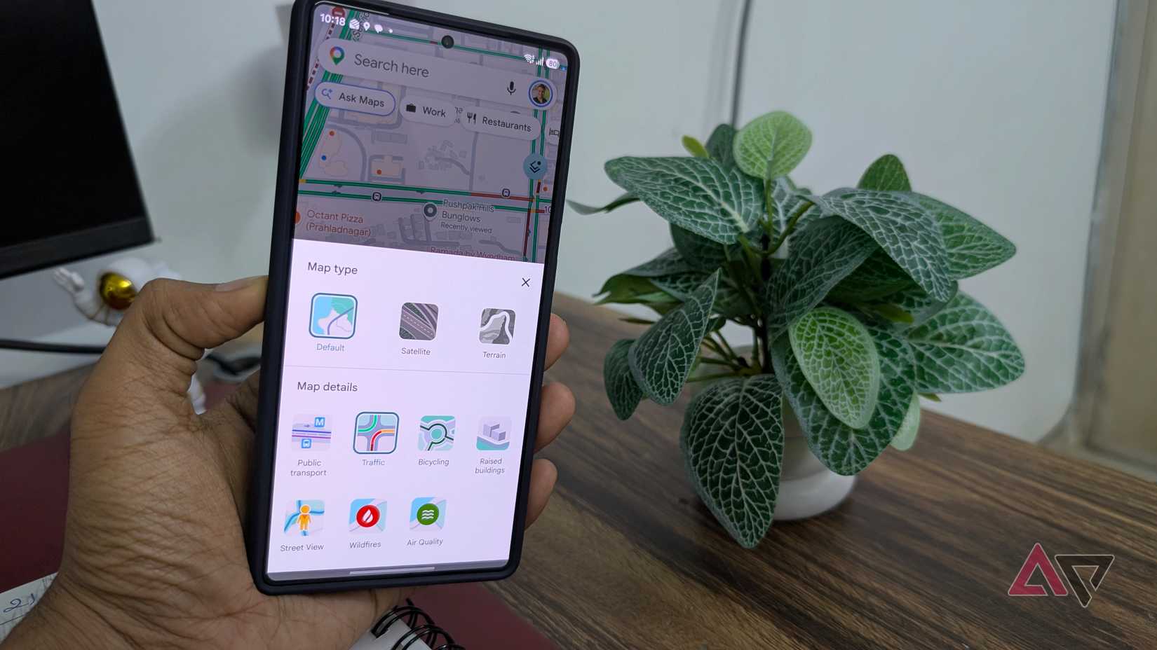
After planning my trip with departure or arrival times, I do a final live traffic check before leaving.
I usually open Google Maps, tap the option from the top menu, and switch on to see what the roads look like.
The color-coded overlay gives me an instant idea of where traffic is flowing smoothly and where things are starting to back up.
I like doing this because predicted traffic helps with planning, but real-world conditions can change sooner.
An accident, roadwork, or sudden congestion can completely change the route I had in mind.
This final check only takes a few seconds, but it gives me extra confidence before I leave.
This changed how I plan drives
I still use Google Maps for navigation, but that is no longer the main reason I open it before a drive.
The departure and arrival options changed the way I think about commuting altogether.
Instead of reacting to traffic after I am ready to leave, I can plan around it.
It's a small feature I ignored for too long, and it has made my daily drives easier to plan.